
Zero In on Vermont Spans
Switch on the Covered Bridge filter to pinpoint historic spans across Bennington, Woodstock, Stowe, and the Northeast Kingdom without commercial distractions.
From the crimson timber trusses of Bennington County to the winding river bends of Route 100 and the Mad River Valley, Vermont boasts the highest density of covered bridges per square mile in North America. WanderWay turns every weekend drive into an authentic heritage tour.
$4.99 one-time purchase · Zero subscriptions · Zero ads · 100% private
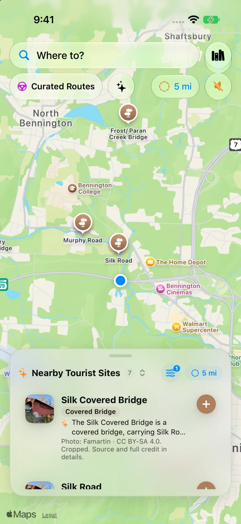
Silk Covered Bridge, Burt Henry, and Murphy Road in a tight 5-mile country loop. Complete with construction notes and Wikipedia photography.
Green Mountain Touring
Say goodbye to interstate reroutes. WanderWay keeps you on the backroads where New England heritage thrives.
Switch on the Covered Bridge filter to pinpoint historic spans across Bennington, Woodstock, Stowe, and the Northeast Kingdom without commercial distractions.
As you approach bridges like Silk Road or Chiselville, WanderWay announces their presence and bearing ("Ahead on your left...") so you can enjoy the foliage safely.
Vermont's mountain hollows frequently drop cell reception. Pin your regional routes before leaving town to retain 100% offline navigation and voice guidance.
Choose an afternoon timeframe, select 'Prefer Scenic Backroads', and let WanderWay stitch together quiet gravel country roads and historic bridges back to your inn or driveway.
Vermont FAQ
Common questions about exploring Vermont's scenic byways with WanderWay.
WanderWay features a dedicated Covered Bridge category filter powered by OpenStreetMap and National Register data. It surfaces historic spans like Bennington's Silk Covered Bridge, Paper Mill Village, and Burt Henry Bridge, announcing their approach with directional spoken voice audio.
Yes. WanderWay lets you pin and download regional map tiles and historical data directly to your device so you maintain full voice guidance and map discovery even in remote Green Mountain notches and river hollows.
WanderWay is designed specifically for scenic touring. Its Sunday Drive generator allows you to create custom 1- to 4-hour circular routes along Route 100 and rural mountain byways, bypassing interstates to prioritize foliage, covered bridges, and panoramic overlooks.
Ready for the Green Mountains?
$4.99 one-time purchase. No ads, no subscriptions, and zero tracking. iPhone and Apple CarPlay on iOS 26 or later.