
One Tap Isolates Covered Bridges
Toggle the Covered Bridge filter to remove map clutter and instantly view every authentic Burr arch, Town lattice, and Queenpost truss within up to 35 miles.
Pennsylvania is home to over 200 historic timber covered bridges—more than any other state in the nation. WanderWay filters out the interstates, builds custom backroad loops through Lancaster County and the Lehigh Valley, and speaks the history of each span as you approach.
$4.99 one-time purchase · Zero subscriptions · Zero ads · 100% private
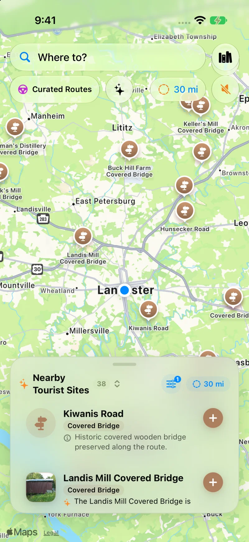
38 covered bridges in a single 30-mile radius across Lancaster, Lititz, and Conestoga Creek. Tap any pin for construction dates, truss styles, and Wikipedia photos.
Touring Pennsylvania Heritage
Standard commuter navigation bypasses historic treasures. WanderWay puts them at the center of your weekend drive.
Toggle the Covered Bridge filter to remove map clutter and instantly view every authentic Burr arch, Town lattice, and Queenpost truss within up to 35 miles.
As you approach spans like Landis Mill, Hunsecker Road, or Keller's Mill, WanderWay speaks where they are relative to your car ("Ahead on your right...") without interrupting your music.
Don't spend hours stringing together GPS waypoints. Select 2 hours, toggle 'Prefer Scenic Backroads', and let WanderWay plan a loop connecting multiple bridges back to your start.
Plug into Apple CarPlay to see live bridge pins, upcoming turnouts, and historic summaries directly on your vehicle's dashboard screen.
Pennsylvania FAQ
Everything you need to know about exploring Pennsylvania's historic bridges with WanderWay.
WanderWay connects directly to the National Register of Historic Places and OpenStreetMap, giving drivers instant access to Pennsylvania's 200+ surviving covered bridges, including all 29 historic spans across Lancaster County.
Yes. WanderWay's Sunday Drive builder lets you pick your available drive time (e.g. 90 minutes or 2.5 hours), filter exclusively for Covered Bridges, and generate a closed-loop backroad route that starts and finishes at your location.
Yes. WanderWay provides directional spoken audio (e.g., 'Ahead on your right: Landis Mill Covered Bridge') so you can keep your eyes on the winding country roads without needing to glance down at your phone.
Yes. You can cache county map tiles and historic data before leaving home, ensuring uninterrupted voice guidance and map exploration even with spotty cellular service.
Start your heritage drive
$4.99 one-time purchase. No ads, no subscriptions, and zero tracking. iPhone and Apple CarPlay on iOS 26 or later.